
11 States and Reno Strom Gathering
|
Day 13 |
John Day, OR French Glen, OR Denio Junction, NV Soldier Meadows, NV ODO 307.4 mi
|
48 dirt miles Also REF: |
[Lisa] We started toward Lake Malheur to see the myriad of birds that are in route on the Pacific Flyway migration heading north. As we crested the foothills, the large expanse of water came into view. In the morning mist it took on an eerie, foggy appearance, with a lot of movement on the water. There were shore birds aplenty, including mallard ducks, egrets, scaups, willets, and lots of red-tailed hawks and osprey.
We rode closer to the lake and saw what looked like smoke on the water, then got closer and could begin to hear the buzzing. Mosquitoes. I looked at Craig and said, "Get us out of here!" as we were pelted by the nasty bugs on all sides. Craig took off quickly, and we found clear air beyond the lake's pull.
We decided to stop for lunch in a small area that had "Joe Mama's" displayed on the side. The menu was decidedly different, offering a roasted chicken & rice dish ("Bentos") that the diner covered with a sauce or dressing of their choice. It was absolutely delicious!
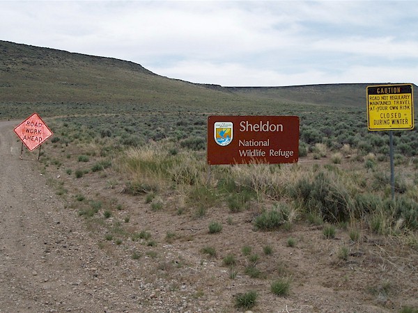
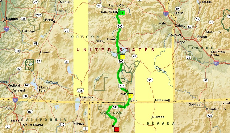
At the junction of SR-140 and
SR-8A you are warned that the road
is not maintained in the Winter. Translation: we'll get serious about
repairing road damage in June. I pick up an obsidian shard.
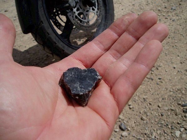
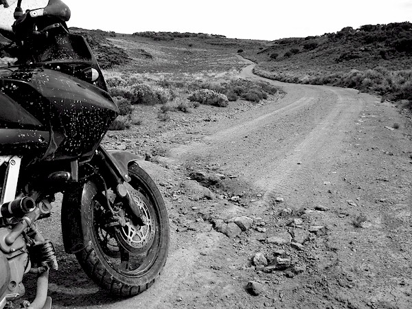
This road is notorious for shredding tires.
The road starts off brilliantly, but even on good surfaces like this
I rarely exceed 40MPH riding 2UP. I always want to be able to stop
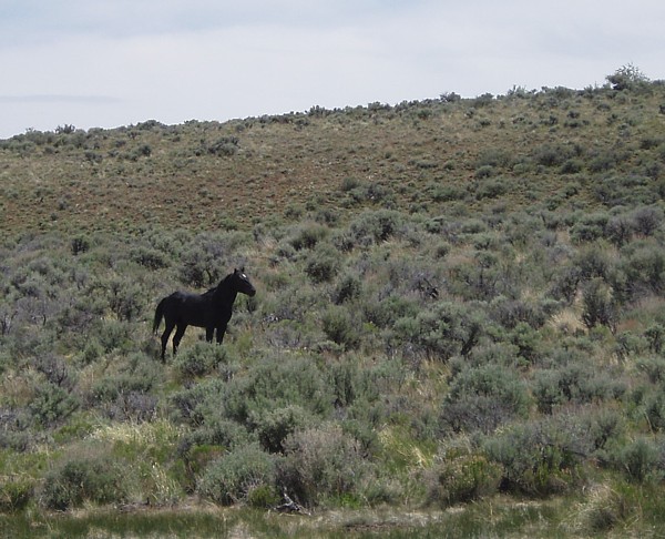
quickly for obstacles (or photo-ops!!). This horse, like me, is free.
Sheldon National Wildlife preserve is home to both wild mustangs
and abandoned horses who have been dropped off or found
there way here. We spotted this horse near a watering hole.
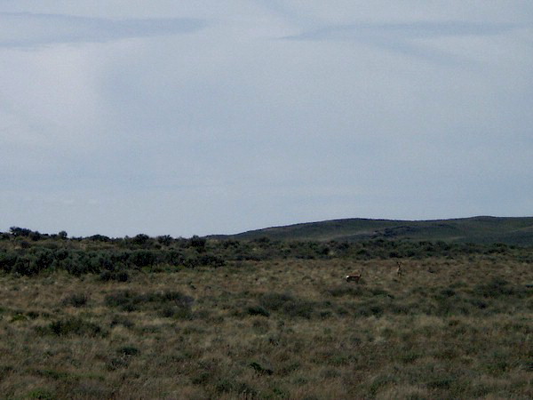
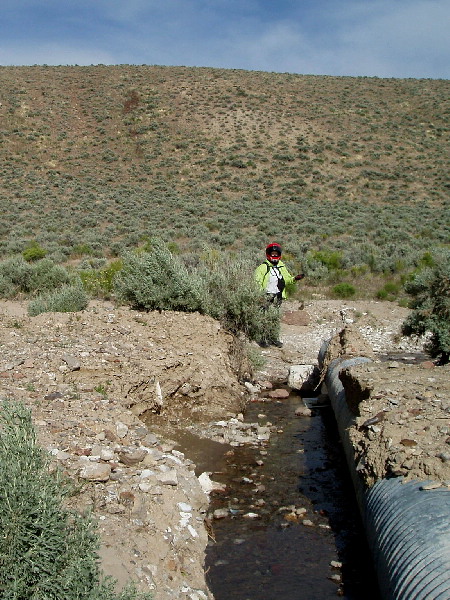
[Lisa] It was a good thing that we didn't stay long at the Lake, because we needed the extra time getting to Soldiers Meadow. The dirt road was washed out in a few places, some areas with water still coursing through. It was a beautiful place that made me want to sing, "Home on the Range" while we rode along. We saw a wild horse, black and healthy and spunky. We were raced by a pair of Pronghorn Antelope, who ran beside us, then across in front of us. We saw hare and kangaroo rats, and red-tailed hawks, and eagles, and a lot of vultures.
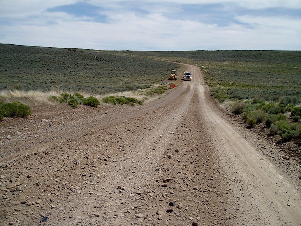
This is the extent of road repair at the moment. Several hundred yards of
gravel thrown over this
section, yet to be worked in (no workers in sight). Pronghorn Antelope on
the range. They kept
a reasonable distance from us and of course moved even further before I
could fumble my camera
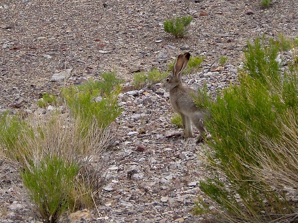
out! It turned out to be rabbits and squirrels that you really had to watch
darting underfoot.
[Craig] After the first unmarked junction (yes it pays to have GPS and some good back-up maps out here) we ran into a couple in a pick-up. They kind of looked at the bike and said told us we weren't likely to make it to Soldier Meadows Ranch today. There were two mudholes ahead. The first was across the entire road (but firm bottomed) and the second was spotty but very deep and soft (they had not found a way to cross). After a bit of discussion they agreed we might be able to work around the mud, but they still weren't too optimistic about our goal of Soldier Meadows.
[Craig] We rode a bit longer (not quite to the mud) and ran across another pick-up that had turned around at the second mudhole. We told him what the other couple had accessed and he agreed, adding that even if we made it past the mud the playa near Summit Lake would be treachorous after the recent rains.
[Craig] At this point we were pretty close to the mud and decided to at least take a look...[Lisa] Over one of the washouts there was a stream that had some pot holes ground into it. Craig told me to get off the bike and scope it out, and he'd ride through. Some things just don't work the way you want them to. He got into it, and tipped over sideways. Ick. Craig wasn't hurt; the was the V-Strom wasn't hurt. Just muddy and dirty...(on the side of my saddlebag!).
[Lisa] We spoke with some folks who were in 4-wheel drive vehicles who told us that we'd never make it through the water, so we were expecting some real gulleys. Wimps. Craig took the bike through all the other crossings with ease. Okay, not ease, but without incident. There was one crossing with a particularly deep crease, and a bottle-neck area in the middle that didn't quite reach across. I saw a board in the road, and asked Craig if it would work. He put it across the breach, and voila! Instant bridge. It worked! I got pictures of him crossing his newly engineered bridge. We were nearly at the ranch.
[Craig] Mudhole number 2. The "truck blockade". People had poked numerous sticks in these holes and pretty much couldn't find the bottom. There was no absolute way across, even for us (albeit some spots were close).
[Craig] Resourceful Lisa notices a 2x6 board lying off the the side and we drop it in place to make a little bridge for me across one of the "bottomless" ditches.
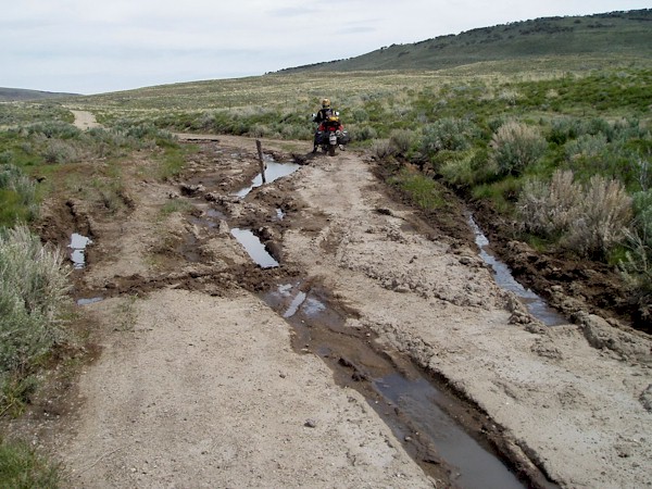
Now this is the bridge Lisa found for me (under the front wheel).
Even if I was eight feet tall I wouldn't want to waddle my legs into
that mud. It is essentially bottomless. I point to front wheel over
the
bridge, throttle up, and gently work that clutch to shoot on across!
Looks easy enough to really $@#$% up good doesn't it?
Past the 2nd mudhole with ease. You can see where bigger
vehicles have struggled. Going around is not an option for
them either, as this is basically where the road is crossing a spring.

We've been riding out ruts in the road from some
time by this
point, but by this time we are starting to run across erosion features
cutting across the road. Stuff like this is shallow enough to ride out,
but
bigger ones require a gentle "roll through". Better to slow down
for all
of them until you can really know for sure how deep they are. Here's
a shot of the whole bike at the same spot. Did I mention we're at 950 lbs;
600 lbs over the rear tire and 350 lbs over the front (with a failing
right
fork seal)? Take it easy out here...
[Craig] Soon after mudhole number 2, we spotted vehicle number 3. This would be the last occupied vehicle we would encounter in 100+ miles (over the course of two days). It was a Jeep CJ, which apparently was the only 4 wheel tool that could negotiate mudhole number 2. They also gave us a pessimistic outlook on the playa ahead. At this point I didn't press them too much on the condition (or whether they knew firsthand). We were going to check it out no matter what. If we couldn't cross, we couldn't cross.
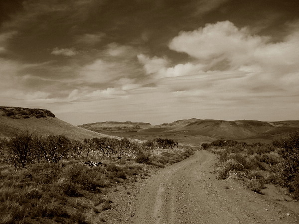
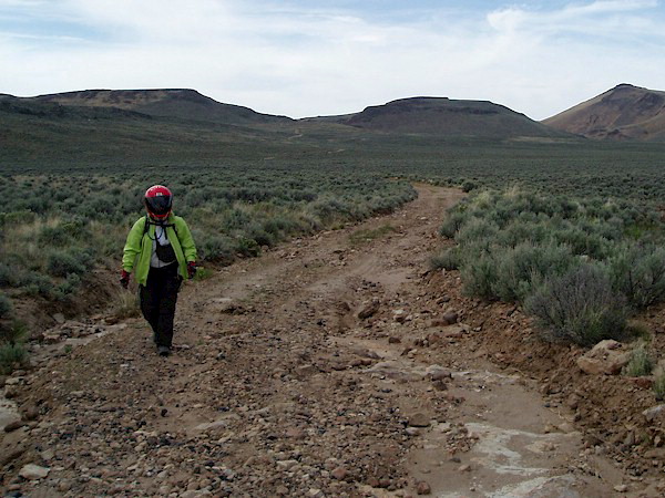
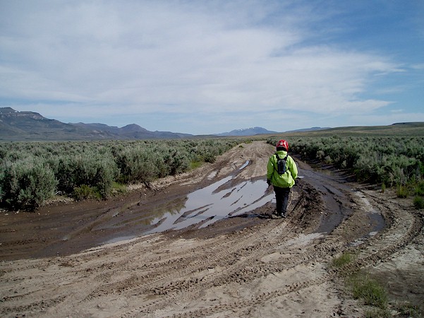
Beautiful country. Something to behold around every bend or crest
in the road. Lisa had to hoof it several hundred yards over the course
of
our "Northern Passage" to Soldier Meadows. Here you can see
some
of the nuttier conditions. The deep sand I could get her through, but I
had
concerns about bottoming out through rocky sections that got steep riding
2UP.
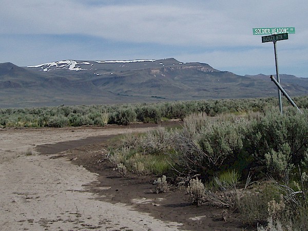
Oddly enough this intersection in the middle of nowhere had a street
sign.
This was the stretch at the end of the section of road crossing the
playa
everyone was warning us about. You can see the road had not dried
out completely along the edge, but for the most part the road was rock
hard. We took it with a bit of caution considering that there might
be sections where the surface might fail, but we had no trouble. Just a
bit
around the corner from the last photo was our last sign of mud for the day.
[Lisa] Then we saw it. The BIG washout... Fortunately, other drivers of much larger vehicles had been through and cut a path adjacent to the completely washed out road, so we were able to cross. With me, off the bike, of course.
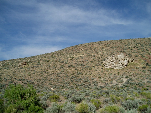
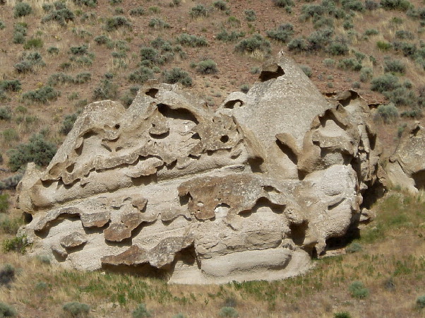
As I my eyes were peeled on the road surface,
Lisa spotted a funny volcanic rock
off to our left. They funny erosion on the volcanic rock looked almost
artificial,
standing out considerably on the hillside. Lisa poses in one
significant
erosion feature. One reason to keep those speeds down a tad out here!
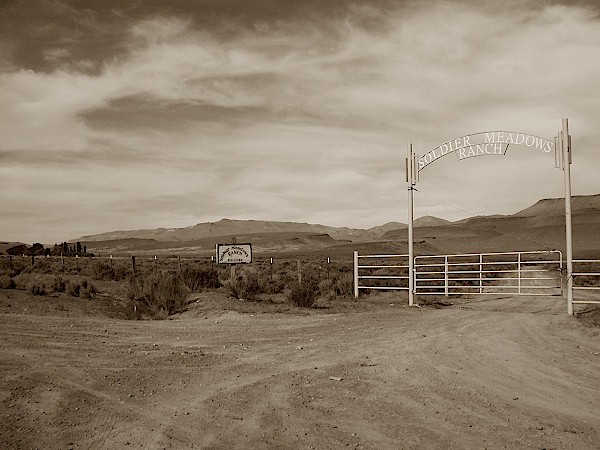
[Lisa] Soldiers Meadow is a lovely ranch with grand vistas and friendly folks. We were greeted by a dog named Patsy Cline, and a lady named Charley. She was a former Ocean Beach (CA) resident who treated us like we were her personal guests. What a welcome! Craig unloaded the bike and I got us settled into the room. This was a working ranch, so we were in a ranch hand room. The ranch house is huge and rambling, with a big kitchen and dining area where we sat down to eat with the cowboys and cowgirls of the ranch, including Albert, Charley's other half.
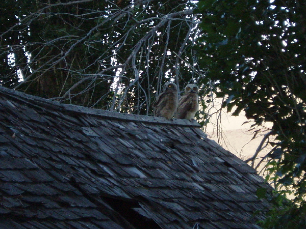
[Lisa] We enjoyed a beautiful sunset, watching two fledgling owls practicing early evening flight. We had a big dinner, feasting on chicken, mashed potatoes, salad, and bread. There was even brownies and cookies for dessert! We were not the only ones feasting, however. I got eaten up by the mosquitoes. Again. Between the lake and the meadows, I was pretty chewed up. Oh well. The price of a glorious view!
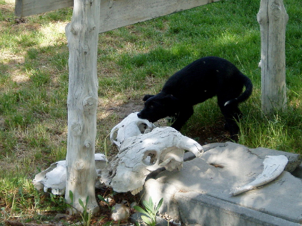
Chew Toy - Nevada Style!!
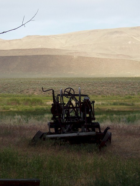
Derelict equipment
Next: Day 14

